The Cana Archaeological Survey (2007-2013) was designed to explore the evolution of the town of Cana on the Abomey Plateau (Bénin), and its functional relationships with their broader hinterlands. This project examines urbanism, population dynamics and settlement structure in rural hinterlands, and historical memories of dislocation, relocation, and incorporation into Dahomean society by families descended from captives. This project uses archaeological survey, excavation, and interviews with local informants in and around Cana, a pre-colonial urban center a mere eleven kilometers southeast of Abomey the pre-colonial capital of the Kingdom of Dahomey.
Cana
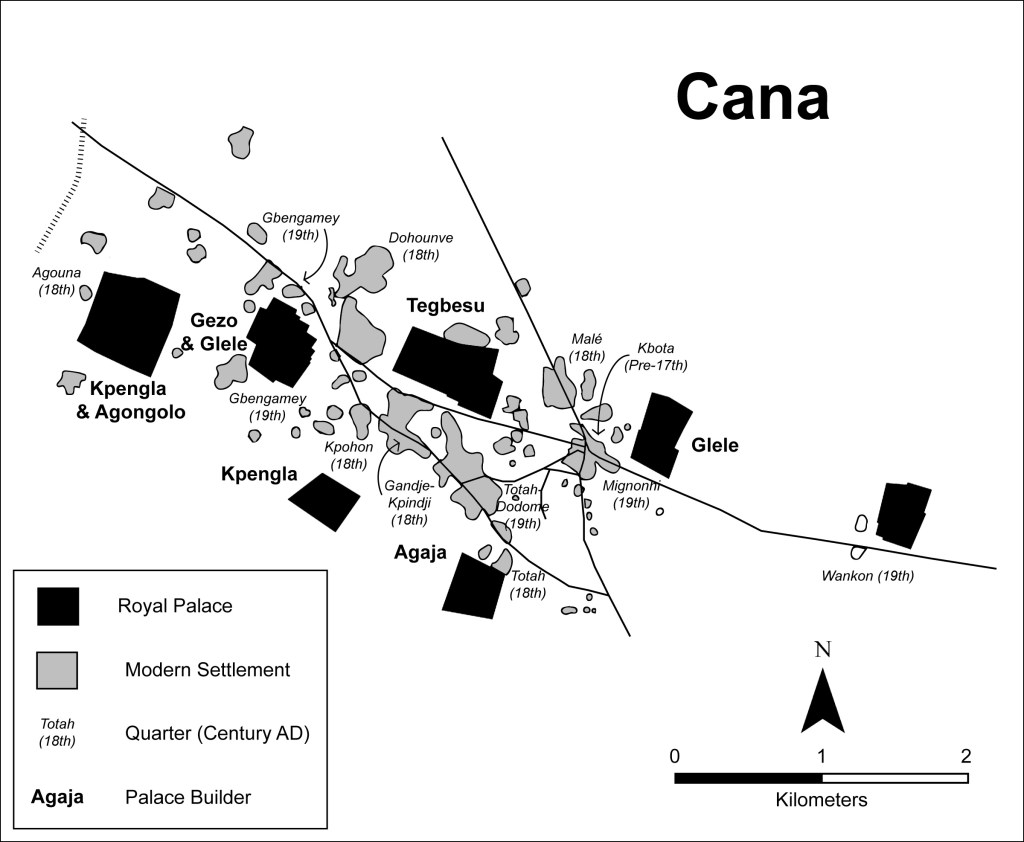
Documentary sources indicate that during the eighteenth and nineteenth centuries, the Abomey Plateau was characterized by a multi-centric urban pattern centered on two neighboring cities: Abomey and Cana. Abomey in this period was an expansive community surrounded by a rectilinear wall and ditch system, an anomaly in the urban ditches of West Africa. Nearby Cana, located 11 kilometers to the southeast, also emerged as a major economic center on the plateau during this same period. Cana originated as a Guedevi settlement prior to the arrival of the Fon on the plateau. Cana also boasted regional markets, served as a major node in regional administration and inter-regional trade routes, and its population in the eighteenth century may have reached as many as 15,000 inhabitants. Despite evidence for population decline by the late nineteenth century, Cana continued to support a substantial population numbering anywhere from 5,000 to 25,000 inhabitants. Although a good deal can be learned from the historical record about the city itself, the same is not yet true of the broader settlement system into which it was articulated. The Cana Archaeological Survey was designed to fill this gap, exploring the broader history of settlement andn urbanism at Cana, and it relationship to villages across its rural countryside.
Survey Methods
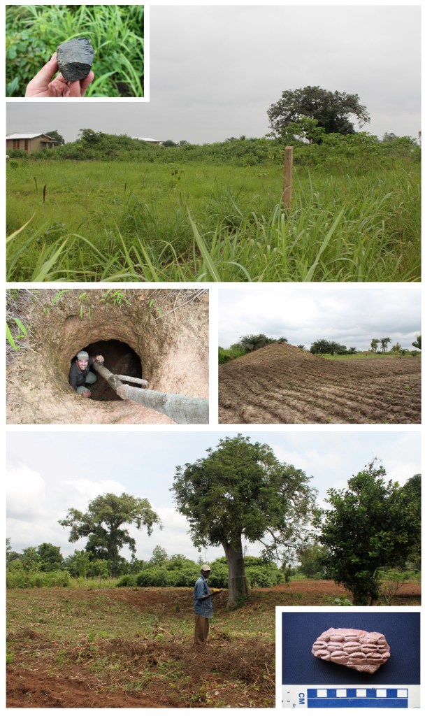
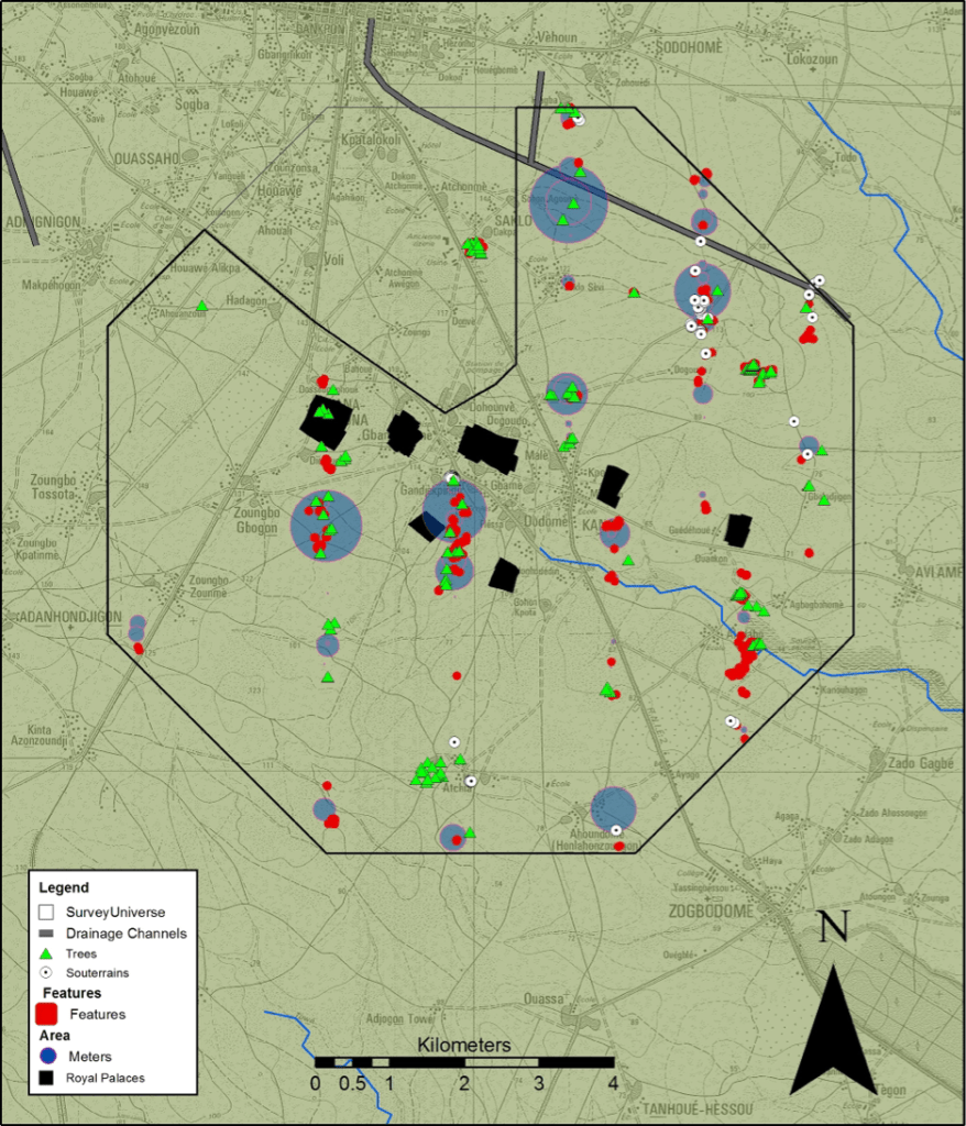
The methodology employed by this research project was geared towards identifying archaeological sites in Cana’s rural hinterland. Archaeologists worldwide accept the use of subsurface testing along survey transects for the systematic identification of archaeological sites across large regions. Such survey transects were adopted as the most logical strategy for identifying sites on the Abomey Plateau. Transects can be of varying lengths and widths, and the area they contain can be sampled archaeologically in many different ways. The study area was defined as the total area enclosed within an octogon 10 kilometers in diameter centered on Cana. This area was then divided into at total of 10 one-km-wide north-south survey blocks extending to the northern and southern limits of the study area. One survey transect was selected at random, running north or south of the main road within each survey block. Along these survey transects, team members excavated shovel test probs at 50 meter intervals, and initiated full coverage surface survey in open fields, to recover artifacts and identify surface features indicative of human settlement across the region.

Survey Results
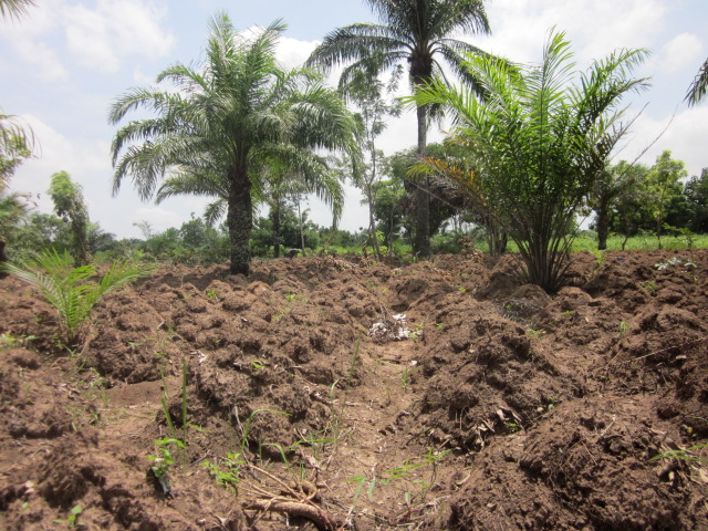
This systematic survey covered 1.5 square kilometers of ground, (2% of the region), excavated 1322 shovel test units, surveyed 242 fields, and mapped over 300 features using mapping grade GPS units. 87% of shovel test pits excavated were positive for artifacts. Survey identified a range of archaeological features visible on the surface, including abandoned villages, industrial sites, ritual centers, and evidence for farming activities dating from the first to the second millennium AD.
Additionally, subsurface testing allowed us to infer the location of archaeological sites based on the locations of high densities of artifact remains. Both data sets suggest a complex settlement pattern in which dozens of smaller villages and hamlets were scattered throughout Cana’s hinterland in the precolonial period.
Oral Historical Methods
In addition to traditional survey methods, oral history was employed to track local memories of urban growth and transformation over time. Oral sources from community members at Cana contain complex narratives of resettlement, war, and slave trading in which the state had a heavy hand in structuring the social landscape of these cities. Lineage histories from Cana demonstrate the close synergy between the spatial distribution of noble and commoner lineages and royal palace construction campaigns across the urban landscape. For each palace constructed at Abomey, both noble and commoner lineages were installed in neighboring quarters, and many of these lineages were of non-local origin

Collectively these data are providing valuable new insights into the deep histories of settlement in this region, as well as the the regional dynamics of urban transformation in the era of the slave trade. Although the analysis and interpretation of this survey material is underway, it is clear that the region holds enormous potential for future archaeological research.
