Saclo Village Archaeology (2022-present), a collaboration between the University of California Santa Cruz and the University of Abomey-Calavi, examines the longue durée growth, development, and transformation of a village community on the Abomey Plateau in Bénin. Focusing on the village site of Saclo, Saclo Village Archaeology seeks to understand how villages on the Abomey Plateau adapted over two thousand years of social, economic, and political transformations, culminating in the onset of the trans-Atlantic slave trade and the rise of the Kingdom of Dahomey in the 18th century.
Discovery
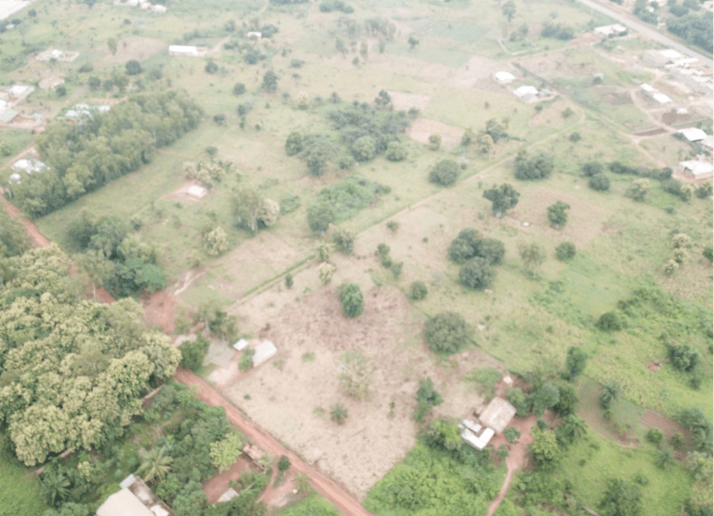
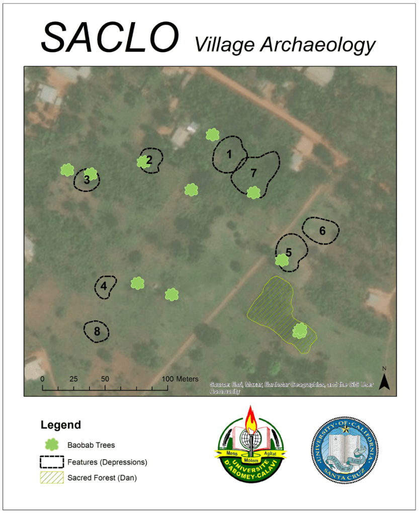
The site was discovered in 2013 during archaeological surveys around Cana led by J. Cameron Monroe as part of the Cana Archaeological Survey (2007-2013). During that survey, features characteristic of ancient settlement across the Abomey Plateau were identified, including large depressions, baobab trees, and a sacred forest. Such depressions, which range from 20 to 35 meters in diameter at Saclo, were originally excavated as clay pits to build housing nearby, and subsequently filled with trash as the community went about its everyday routines.
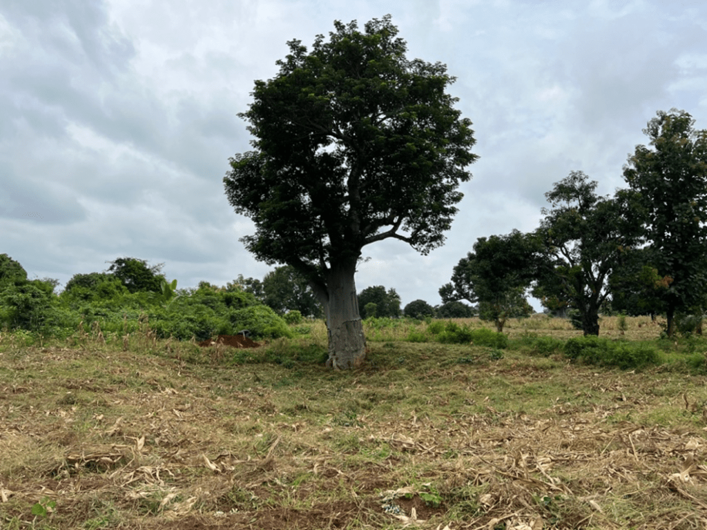
On precolonial settlements in Dahomey, Baobabs provided sources of fruit and medicines, and served important ritual functions. Local community members indicate that baobab trees were owned by distinct family lineages. Archaeologically, baobabs are commonly associated with old trash pits, presenting the opportunity to study the remains of individual families in the past. Additionally, sacred forests are ritual spaces left to turn back to nature, and, in many West African contexts, often mark the locations of early domestic sites and/or other settlement components of the founding members of the community. When these features are all found together the presence of an archaeological of importance is beyond doubt.
Mapping in 2013 revealed a ring of 8 large depressions covering an area approximately 40 hectares in size (Figure 5). Our excavations in the two depressions on the northern extent of the site (Features 1 and 5) revealed deposits of everyday midden made of large quantities of local pottery, and smaller quantities of imported material (pottery, pipes, glass, cowries, etc.) dating to the era of the trans-Atlantic slave trade (18th and early 19th century)
Methods
We returned to Saclo in 2022 to expand archaeological survey and excavation across the site. For the 2022 field season, our objectives were quite simple. We sought to understand the spatial organization and limits of the site, to identify potential households to excavate in the future, and to expand our archaeological testing campaigns to a few more depressions. We hoped by the end of the field season to have a clearer picture on the spatial and chronological patterns at Saclo, in preparation for future research targeting individual households across the site.
To recover this kind of evidence for the entire site rapidly, we opted to use a novel methodology that has become standard practice in the archaeology of forested areas with low visibility in the Americas, and which was deployed very successfully by Monroe during his five-season survey around the town of Cana: shovel test pits (STPs).
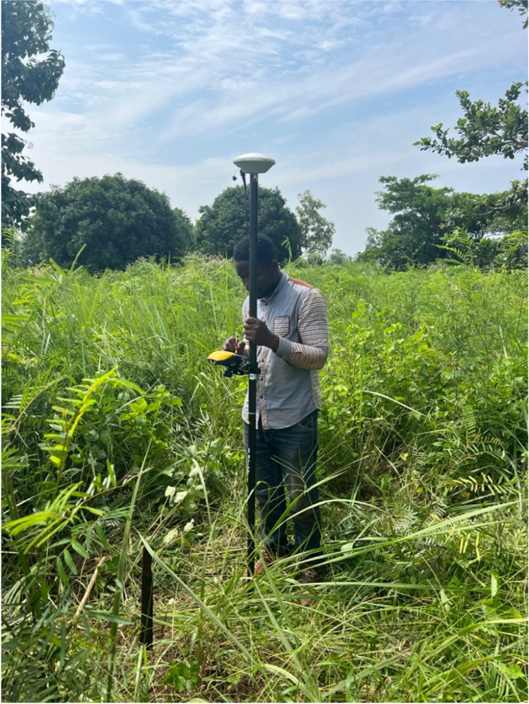
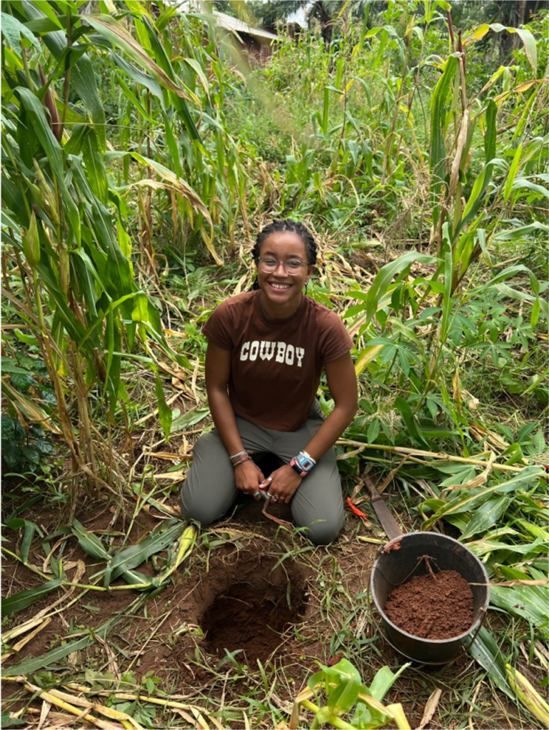
At Saclo, shovel test pits were excavated on a regular 20-meter grid across the site, covering an area of approximately 50 hectares (200×250 meters). This survey identified multiple areas of high density occupation across Saclo. Analysis of the ceramics recovered in these STPs, furthermore, suggests settlement at Saclo commenced as far back as the middle of the 1st millennium AD. Analysis of this data is currently underway and will be presented here post-publication.
